
I am letting you have a break (no pun with above heading intended) from my ugly mug this Saturday morning so – instead – some notes from home rather than a chat in the churchyard.
Yesterday l was pondering on the origins of a strange sign beside the Gloucester Road (old stretch of the A46) that l pass daily on my way up to Upper Swainswick.
What l asked is an Anchor Post? My thanks to John Branston for the following:
“I’m fairly sure that the lay-by in question is the remnant of one of two or more ‘escape lanes’ that were installed for vehicles whose brakes had failed (or ‘faded’ through heat) coming down the long incline of the old A46. Old drum brakes were prone to overheating, especially on overloaded vehicles, or if the brakes were worn.

The lay-by is preceded by signs recommending that drivers ‘Try your brakes’. Having tried ones brakes and finding them to be next to useless, ones thoughts immediately and rather urgently turn to what to do about it and… voila!… the escape lane appears, taking the form of a 100-yard long pit full of soft gravel, designed to slow and stop the vehicle. The vehicle would then end up sunk into the gravel to an appreciable degree.

I guess the anchor post was a means of attaching to something substantial in order to winch the sunk vehicle back out. All this has become obsolete as vehicle brakes are much more efficient these days and all the heavy traffic is now on the new A46 road. The long gravel pit itself is now overgrown and hidden, but probably still there.

That’s my suggested solution to your conundrum!”
Thanks again John. While we’re talking about highway matters, l wonder how many of you remember these.

This particular “AA Your Route” was a Christmas present from friends who knows l like th weird and wonderful.

These days we have sat nav to guide us along an unfamiliar A to B motoring route, but years ago this was one of the services available to members of the Automobile Club. You would have your route prepared for you.

This one covering the 73-odd miles from the New Forest village of Minstead in Hampshire to Bath.
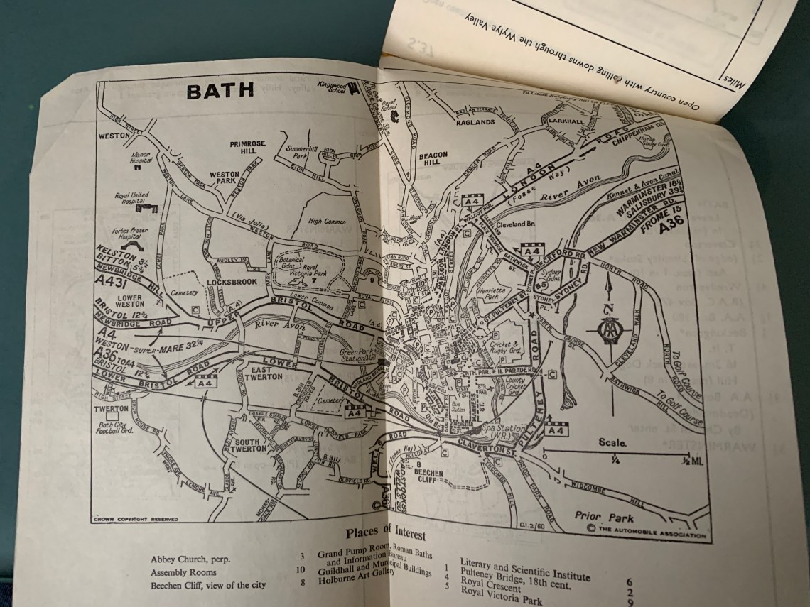
I think it dates from the mid 1960’s as there is a reference to the ‘new motorways’ included in it!
I recall the AA route guides my dad would request for our annual holiday trip (often to some distant Butlin’s camp). I believe they’d sometimes get odd requests from some drivers, such as routes with no right turns.
My husband remembers using these in the 1960s to go to Devon and Cornwall. The family were once sent one which started not from their home but from another village with the same name in a different county, so they modified their route to go southward until it coincided with the AA’s directions.
As for escape lanes, there is one on the new bypass.
https://www.sabre-roads.org.uk/wiki/index.php?title=Escape_lane
Not sure how old this link is but it shows the locations where escape lanes are still in existence. The one on the A39 heading down into Wells is definitely still there. It also lists the one on the A46 (Swainswick) approaching Bath. Can also recall my father using the ‘tailored’ AA route maps for trips around the UK in such delightful (and unreliable!) cars as an Austin 7, Austin 10 and Humber Hawk. Those were the days!
Oh, I do love a weird and wonderful map! Good story 😘